![](/images/other/stat-length.png)
![Excursión Otra actividad Les Baux-Sainte-Croix - chemin des postiers en chantier - Photo](https://media.geolcdn.com/t/1900/400/ext.pjpeg?maxdim=2&url=https%3A%2F%2Fservices.sitytrail.com%2FGeolivesWS%2FDownloadMedia.ashx%3FTrailID%3D448902%26Media%3Dfix__20140503122847.jpg)
chemin des postiers en chantier
fredtruc27
Usuario
![Longitud](/images/other/stat-length.png)
Longitud
19 km
![Altitud máxima](https://static1.geolcdn.com/siteimages/upload/files/1508320355ic_sort_altitude_max_24dp.png)
Altitud máxima
157 m
![Desnivel positivo](https://static1.geolcdn.com/siteimages/upload/files/1508320355ic_sort_den_pos_24dp.png)
Desnivel positivo
233 m
![Km-Effort](/images/other/stat-length.png)
Km-Effort
22 km
![Altitud mínima](https://static1.geolcdn.com/siteimages/upload/files/1508320355ic_sort_altitude_min_24dp.png)
Altitud mínima
77 m
![Desnivel negativo](https://static1.geolcdn.com/siteimages/upload/files/1508320355ic_sort_den_neg_24dp.png)
Desnivel negativo
233 m
![Boucle](https://static1.geolcdn.com/siteimages/upload/files/16400158638029165_repeat_loop_refresh_sync_direction_icon.png)
Boucle
Sí
Fecha de creación :
2015-07-23 00:00:00.0
Última modificación :
2015-07-23 00:00:00.0
![Otra actividad](https://static1.geolcdn.com/sitytour/trail-icons/900.png)
1h39
Dificultad : Desconocido
![Escanee este código QR para abrir la excursión en la aplicación SityTrail](https://capi.geolives.com/qq0zvz2zws4bq2lad0pu/sitytour/trails/448902/qr.png?size=200)
Aplicación GPS de excursión GRATIS
A propósito
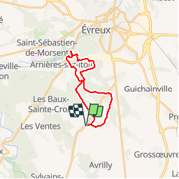
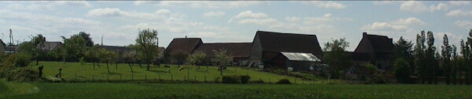
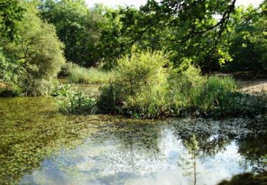
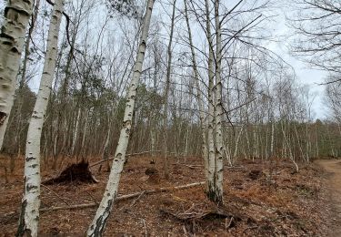
Ruta Otra actividad de 19 km a descubrir en Normandía, Eure, Les Baux-Sainte-Croix. Esta ruta ha sido propuesta por fredtruc27.
Descripción
petite balade en vtt pour voir les travaux au pont du chemin des postiers où sont commencés les travaux du contournement d'Evreux.
Localización
País:
France
Región :
Normandía
Departamento/provincia :
Eure
Municipio :
Les Baux-Sainte-Croix
Localidad:
Unknown
Salida:(Dec)
Salida:(UTM)
362977 ; 5424245 (31U) N.
Comentarios
Excursiones cerca
![Excursión Bici de montaña Arnières-sur-Iton - La balade des copains - Arnieres sur Iton - Photo](https://media.geolcdn.com/t/375/260/ext.jpg?maxdim=2&url=https%3A%2F%2Fservices.sitytrail.com%2FGeolivesWS%2FDownloadMedia.ashx%3FTrailID%3D103963%26Media%3D6851_2.jpg)
![Bici de montaña Bici de montaña](https://static1.geolcdn.com/sitytour/trail-icons/202.png)
La balade des copains - Arnieres sur Iton
Bici de montaña
Difícil
(1)
Arnières-sur-Iton,
Normandía,
Eure,
France
![](/images/other/stat-length.png)
34 km | 41 km-effort
2h 19min
![](https://static1.geolcdn.com/siteimages/upload/files/16400158638029165_repeat_loop_refresh_sync_direction_icon.png)
Sí
![Excursión Senderismo Les Ventes - Petit circuit de la Pierre de Courcoulée.20/03/23 - Photo](https://media.geolcdn.com/t/375/260/914b69b2-bbec-487d-b2eb-519e3d4739f2.jpg&format=jpg&maxdim=2)
![Senderismo Senderismo](https://static1.geolcdn.com/sitytour/trail-icons/101.png)
Petit circuit de la Pierre de Courcoulée.20/03/23
Senderismo
Muy fácil
Les Ventes,
Normandía,
Eure,
France
![](/images/other/stat-length.png)
3,7 km | 4,1 km-effort
1h 13min
![](https://static1.geolcdn.com/siteimages/upload/files/16400158638029165_repeat_loop_refresh_sync_direction_icon.png)
Sí
![Excursión Otra actividad Le Plessis-Grohan - cimetière allemand - Photo](https://media.geolcdn.com/t/375/260/ext.jpg?maxdim=2&url=https%3A%2F%2Fservices.sitytrail.com%2FGeolivesWS%2FDownloadMedia.ashx%3FTrailID%3D448901%26Media%3Dfix__20140517123528.jpg)
![Otra actividad Otra actividad](https://static1.geolcdn.com/sitytour/trail-icons/900.png)
cimetière allemand
Otra actividad
Muy fácil
Le Plessis-Grohan,
Normandía,
Eure,
France
![](/images/other/stat-length.png)
51 km | 55 km-effort
2h 20min
![](https://static1.geolcdn.com/siteimages/upload/files/16400158638029165_repeat_loop_refresh_sync_direction_icon.png)
No
![Excursión Bicicleta Le Plessis-Grohan - cimetière allemand - Photo](https://media.geolcdn.com/t/375/260/ext.jpg?maxdim=2&url=https%3A%2F%2Fservices.sitytrail.com%2FGeolivesWS%2FDownloadMedia.ashx%3FTrailID%3D302651%26Media%3Dfix__20140517123528.jpg)
![Bicicleta Bicicleta](https://static1.geolcdn.com/sitytour/trail-icons/200.png)
cimetière allemand
Bicicleta
Muy fácil
Le Plessis-Grohan,
Normandía,
Eure,
France
![](/images/other/stat-length.png)
51 km | 55 km-effort
2h 20min
![](https://static1.geolcdn.com/siteimages/upload/files/16400158638029165_repeat_loop_refresh_sync_direction_icon.png)
No
![Excursión Bici de montaña Les Baux-Sainte-Croix - chemin des potiers en chantier - Photo](https://media.geolcdn.com/t/375/260/ext.jpg?maxdim=2&url=https%3A%2F%2Fservices.sitytrail.com%2FGeolivesWS%2FDownloadMedia.ashx%3FTrailID%3D273268%26Media%3Dfix__20140503122847.jpg)
![Bici de montaña Bici de montaña](https://static1.geolcdn.com/sitytour/trail-icons/202.png)
chemin des potiers en chantier
Bici de montaña
Muy fácil
Les Baux-Sainte-Croix,
Normandía,
Eure,
France
![](/images/other/stat-length.png)
19 km | 22 km-effort
1h 39min
![](https://static1.geolcdn.com/siteimages/upload/files/16400158638029165_repeat_loop_refresh_sync_direction_icon.png)
Sí
![Excursión Senderismo Sylvains-lès-Moulins - Circuit du Moulin du Coq - Villez - Photo](https://media.geolcdn.com/t/375/260/ext.jpg?maxdim=2&url=https%3A%2F%2Fservices.sitytrail.com%2FGeolivesWS%2FDownloadMedia.ashx%3FTrailID%3D112487%26Media%3D10663_3.jpg)
![Senderismo Senderismo](https://static1.geolcdn.com/sitytour/trail-icons/101.png)
Circuit du Moulin du Coq - Villez
Senderismo
Fácil
Sylvains-lès-Moulins,
Normandía,
Eure,
France
![](/images/other/stat-length.png)
7,3 km | 8,2 km-effort
1h 49min
![](https://static1.geolcdn.com/siteimages/upload/files/16400158638029165_repeat_loop_refresh_sync_direction_icon.png)
Sí
![Excursión Senderismo Les Ventes - Forêt des Ventes - Photo](https://media.geolcdn.com/t/375/260/ad607410-9c41-468c-8e4b-988c945aacf4.jpg&format=jpg&maxdim=2)
![Senderismo Senderismo](https://static1.geolcdn.com/sitytour/trail-icons/101.png)
Forêt des Ventes
Senderismo
Fácil
Les Ventes,
Normandía,
Eure,
France
![](/images/other/stat-length.png)
5,1 km | 6,1 km-effort
1h 22min
![](https://static1.geolcdn.com/siteimages/upload/files/16400158638029165_repeat_loop_refresh_sync_direction_icon.png)
Sí
![Excursión Senderismo Les Ventes - La tringale - Villalet - Photo](https://media.geolcdn.com/t/375/260/8ba89c86-5160-406d-8434-a9cc0ad2fe9e.jpg&format=jpg&maxdim=2)
![Senderismo Senderismo](https://static1.geolcdn.com/sitytour/trail-icons/101.png)
La tringale - Villalet
Senderismo
Medio
Les Ventes,
Normandía,
Eure,
France
![](/images/other/stat-length.png)
13,5 km | 15,5 km-effort
3h 34min
![](https://static1.geolcdn.com/siteimages/upload/files/16400158638029165_repeat_loop_refresh_sync_direction_icon.png)
Sí
![Excursión Bici de montaña Les Baux-Sainte-Croix - Garel - les Ventes - le Sac - Villalet - les Ventes - Garel - Photo](https://media.geolcdn.com/t/375/260/1ffe162c-834e-425a-a7c2-0757192a7546.jpg&format=jpg&maxdim=2)
![Bici de montaña Bici de montaña](https://static1.geolcdn.com/sitytour/trail-icons/202.png)
Garel - les Ventes - le Sac - Villalet - les Ventes - Garel
Bici de montaña
Medio
Les Baux-Sainte-Croix,
Normandía,
Eure,
France
![](/images/other/stat-length.png)
31 km | 35 km-effort
2h 3min
![](https://static1.geolcdn.com/siteimages/upload/files/16400158638029165_repeat_loop_refresh_sync_direction_icon.png)
Sí